Community Map
Our Firewise community is centered around Robie Drive in Auburn, California, on the edge of the American River Canyon.
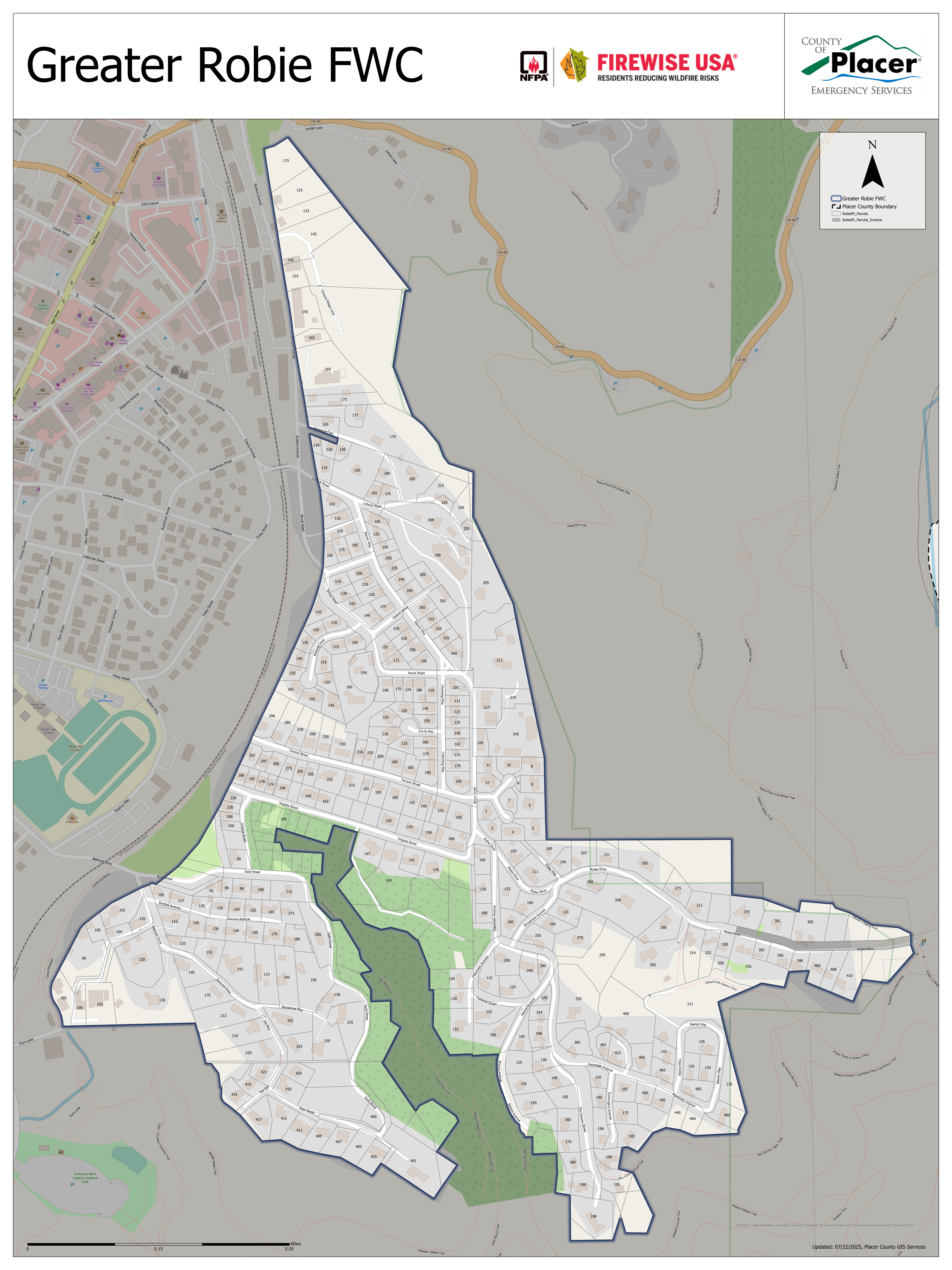
Greater Robie FWC Boundaries
The map below shows the official boundaries of the Greater Robie Firewise Community. This area encompasses neighborhoods around Robie Drive and adjacent streets, extending to the edge of the American River Canyon.
Interactive Map
Explore our neighborhood on Google Maps. The Robie Area Firewise Community sits along the rim of the American River Canyon, placing us in the wildland-urban interface.
About Our Area
Wildland-Urban Interface
Our neighborhood is located in the wildland-urban interface (WUI), where homes and wildland vegetation intermix. This means wildfire risk is elevated and defensible space is especially important for every property.
American River Canyon
The American River Canyon borders our community. While beautiful, canyons can channel winds and accelerate wildfire spread. The Auburn City Fire Department has developed the American River Canyon Shaded Fuel Break to help protect our area.
Fire Hazard Severity
CAL FIRE's updated maps show that Auburn's very high fire hazard severity zone has grown to over 800 acres. Check your property's fire hazard zone on the CAL FIRE FHSZ maps.
Part of a Larger Network
The greater Auburn area has 23 active Firewise communities, with more pending. We work together through the Greater Auburn Area Fire Safe Council to share resources and strengthen our collective preparedness.